Sunday, October 02, 2011

Mount Whitney - The Mountaineer's Route

The Mountaineer's Route was first climbed by John Muir in 1873.  He didn't have to sweat about getting a permit.  Fortunately, by showing up the day before our climb, my friend Sym and I were able to obtain a one day permit for this route.  We started up route round 0500.  If we had actually left at around 0100, we might have made the summit.  For those interested in the details of the day, read on.


Sym at Sunrise Below Lower Boy Scout Lake

We pressed on on Iceberg lake.  I recall the steep snow climb from 09', but today, the cairned route was better.  We came across climbers who had finished the east buttress route of Whitney and were descending at 0930.  I was impressed.  Shortly after this, we had the first precip.  There had been dark skies, but the reality hit with the light hail and thunder in the distance.  By Iceberg Lake, we had anther more serious hail storm.  Lightening, thunder seemed close by near the summit and it hailed for about 30 min.  We were now in the sub-chute, to the left of the main chute to the 'notch'.  This would avoid the small snow field at the bottom of the couloir.

Mt. Whitney East Face

After the Hail
We discussed our options and continued up the steeper part of the couloir that was a class 3 scramble, tricking in places because it was slick with melting hail.  After the steep section, the couloir eased off and walking was easier.  We passed about 4 groups retreating who had turned around.  2 of the groups were guided.   One guide cautioned us about he weather.

The Couloir Covered in Styrofoam Hail
We passed another group of 4 or 5 that had summited.  The had climbed to the notch, then climbed to the summit  via the NW back route (that I'm not familiar with).  They descended via the main N gully, using a rope belay.  They had experience electricity and 'buzzing poles'.  They said there were more storms to the west- which we couldn't see from our position.

Highest Point Achieve Before Retreating
We made it to our high point at 13,600ft, and another storm raged around us.  Hail built up very quickly in the couloir as it streamed down the walls.  We didn't know how long this would last and how much more would be coming.  It was a hard decision after all the time and investment to get to this spot, but we turned around and descended in the hail.  It seem to take us a long time to get back to Iceberg Lake.  

It felt like the temperature was plummeting as we ate lunch at the lake.  We were both tired, and began our long trip back.  Eventually, about 2 hours after we descended, the weather did look much, much better, very windy, but no storms.    Of course we debated if we had made the best decision.  In retrospect, we definitely did.  We didn't know the weather would clear up, the route to the summit was dodgy at best in good conditions.  

550pm - we exited the trail and arrived at the car.  So about 13 hour day for an 11.8 mile hike.
Starting elevation:  8365ft   Max elevation:  13,600ft   Gain:  5,235ft

See the complete picture gallery here.

Sunday, September 11, 2011

Keene Complex Fire - Sept. 10


On the morning of Sept. 10th lightning hit this area in the Keene valley around 5am. These images are from either my home or about a mile away from my home. During the day the fire grew with very strong east winds. By the evening, the fire was climbing fast up a valley that is behind Golden Hills. At night the scene was ominous.... until a rain showers made a real dent on putting out many of the fires. 


Complete image gallery, click here.


The following sequence of images shows how the flames in a ravine exploded over just a few minutes.


View after sunset the mountain and surrounding area.

For complete gallery go to my page.


Tuesday, September 06, 2011

Canyon Fire - Sept. 4th


This fire was started after the fatal crash of a light aircraft in the Tehacahpi Mountains.  This was the view I had as I returned from an extended weekend in the Sierra Nevada.

Amateur video here.


Saturday, July 30, 2011

Travel to the Horizon


On my weekend ride I ran into a couple looking for directions to continue their trip from LA ... to New York.  Nicole and Toby have been riding their bikes for 2 years, from Germany, through Asia, Australia, New Zealand, South America, and now North America.  They were about to go up the Lions Trial from Caliente.  A very steep route that kicks my butt on my light road bike with their 40kg touring machines.  Check out their website Travel to the Horizon and click English to get a taste for their amazing trip!  http://www.reise-zum-horizont.com/

Sunday, January 16, 2011

Climbing in New Zealand

I've had a great time in New Zealand, spending time with family and spending time in the mountains.  Wonderful weather, new friends, and exploring some new places.

Christchurch in the Distance from the Top of Castle Hill Peak
The first part of my outdoor adventures included joining the New Zealand Alpine Club "Summer Camp".  This year the camp was up at the Broken River Ski Field Lodges, near Arthur's Pass.  This is a great location for basing all kinds of hikes and climbs from.

Approach Up the Otira River Valley to Mt. Rolleston
This was an attempt to climb Mt. Rolleston via the Otira scree.  We expected that the weather was not going to be great, but were prepared to climb if the weather did clear.  At the head of the valley the rain became continuous and the clouds moved in making the decision to not attempted the scree climb easy.  Still a nice hike in this beautiful region.

Click here for the photo gallery.        

Since the weather was looking not very favorable for the next day or so, my new climbing partner, Nate, and I decided to regroup in Christchurch, planning to go to Mt. Sommers for some trad climbing.  The approach, rated 'easy' by the brochure, was a sweaty, exhausting climb for myself with 38lb pack.

Climbing Opportunities on the Side of Mt. Sommers
(the Pinnacles Hut is  at the right side of the picture)
Nate and I really climbed some great pitches over the few days.  Great weather, fantastic crag (despite using my alpine boots), and nice area (despite a hut at capacity).  The best trad crack climbing is found on the remains of the ancient rhyolite dome of Mt. Sommers.  Side note:  Active Kiwi families are something, as the Pinnacles hut was full of families and kids as young as age 3.  Impressive.

Nate on Repel from "Christian Principals" Wall
Click here for the Mt. Sommers photo gallery. 

Sunday, August 29, 2010

Middle Palisade Peak

Middle Palisade Peak (Photo Paul Kuroda)
Another great weekend in the Sierra Nevada.  Middle Palisade Peak lies in the center of the highest continuous ridge along the Sierra Crest.  Paul had made all the inquiries and plans for a quick trip to climb Middle Palisade Peak over the weekend of Aug 21-22.  Middle Palisade Peak has a number of routes of various levels of difficulty.  Our plans were to attack the 'normal' route, which is generally an extended class 3 scramble.

I arrived at the trail head parking at around mid day on Saturday and met up with Paul and Marija from Las Vegas.  It was smokey in the air, and I realized this was likely coming from the Sheep Fire in King's Canyon.  The approach is a gradual climb from the Glacier Lodge area to our camp at Brainard Lake.  The region is very scenic, and my opinion is that the further north you are in the Sierra, the more green and interesting it becomes.

The Middle Palisade Bowl from the Start of the Trail

We experienced a tough night in high winds.  In a tent, the 30-40 knot gusts were humbling!  The cost of having a light weight tent is not getting much sleep when the sides of he tent continue to threaten to collapse in the winds.  I couldn't imagine trying to climb to over 14,000 feet in these conditions.  We woke up at 4am, and figured that we might as well give the approach a shot, as we could always turn around.  We started up at around 5am in the dark.  From Bernard lake on, it is off-trail, steep hiking on mostly talus and scree slopes.

Marija on the Endless Talus Approach

It took about 5 hours to get to the base of the peak.  We discussed the several options available to climb up the class 3 chute.  Several we had met mentioned getting off-route and turning around, so we consulted our route guides and looked for the obvious and good route that went from the glacier.  Ice axes were helpful in crossing the snow, and we navigated the transition to the rock chute and ledge system up to the main chute.  From there, it was just hard continuous class 3 climbing at high altitude.  My fittness (or lack thereof) is always tested at 13,000 ft.  We were slow and steady, and very careful not to knock rocks off.

Marija on the Long Continuous Chute to the Summit of Middle Palisade Peak

Around noon, we made it to the top!  Very windy down to the south, but nice weather on our side, couldn't be better really.  It was a very small summit tower, and it took some challenging moves to make summit platform.  On the next tower over, another climber provide a picture opportunity.

Climber on Tower


It took us longer to get down, mainly due to the rock fall hazard.  There were now 3 other couples in the chute either going up or down.  Marija and I had to get back to our vehicles that evening, Paul (who demonstrated his wisdom) was spending another night at camp.  I arrived at my car late, and made the long drive back home, spent.


Sunday, July 18, 2010

3 Days, 2 Peaks - Mt. Williamson and Mt. Tyndall


Beginning of the 11 Mile Trail to Shepherd Pass 

Paul, Lori and I set up before sunrise up the Shepherd Pass trail. We'd camped there the night before so we would be ready to get an early start on a trail with a rough reputation. Moving quickly, it still took us 10hrs to hike the 11 miles to camp, which was just beyond Shepherd Pass at over 12,000ft. So that was over 6,000ft of vertical to get there, one of the longest approaches in the Eastern Sierra Nevada. On the way the weather was uncharacteristically (to me at least) stormy! Rain and hail met us at the start of the pass, which brought about a tense discussion on what conditions we might find on the pass. We continued, and much to my surprise, found a wonderful area to camp with fantastic views of the mountains all around.


  We enjoyed an impressive sunset after an active day in the atmosphere.  I tried to get to sleep at 8pm in order to help with the 3:30am wake up (the alpine start), but I was kept awake by the amazing views of the sun as it slipped down the distant mountains.  There was also some anxious thoughts about finding the correct route, which some people have had trouble with.  When the wake up call was approaching, I was already awake, really wondering why we needed to go SO early (this turned out to save us from a downpour that hit camp 10 minutes after we returned).

 
Early Approach to Mt. Williamson

The approach to the foot of Mt. Williamson took 2 hours.  It was typically Sierra talus, hard going, and a little demoralizing to descend 200ft or so before having to go up again.  The beauty of the sunrise in the mountains made the early wake up well worth our while.

We found the route, and commenced climbing up the mountain on the sloping talus.  In the chute, we circumnavigated small snow fields and worked hard in the thin air to make it higher.  I made frequent stops to catch my breath.  The crux of the ascent was an easily attainable chimney.  A little tricky, but fortunately no exposure.


Chimney Move at 14,000ft

 
Summit Photo

We enjoyed our summit, but didn't linger with the clouds moving in.  We were back in camp by 2pm, right before 2 hours of rain showers!  This is quite unusual for this time of year, and I was glad that I had a tent, instead of the usual tarp I carry in the Sierra.

The next day was another early start out for he 2nd summit, Mt. Tyndall.  The route up was a pleasure, as Paul and I quickly ascended the talus on the steep staircase to the summit.  I must have been getting used to the altitude, because I felt much fitter for this climb.


We climbed to the summit in about 90 minutes!  Clouds were rolling in and obscuring Mt. Williamson.  It was good that we had climbed it yesterday, as today there would be no view.  After a very enjoyable 30 minutes on the summit, I was looking forward to the "easy class 2" descent down the northwest ridge.  We spent about 45 minutes trying to find a route where we did not need to climb an airy class 3 gendarme.  After some frustration, we decided to just descend down the north rib that we had climbed.  It was not nearly as fun going down with rockfall a constant concern.  After 3 hours, we made it back to camp, packed up and started down the long descent to the trail head.  I was very pleased that we had made it up both peaks and felt in good shape for the long hike out.  


Most of my gear has lasted well.  When we arrived at camp on the first day, the two seams on my right boot had totally blown out!  All the seams has come undone, the threads just warn through.  Fortunately, Lori had 3 safety pins, which really saved the day (an the trip)!

Tuesday, March 09, 2010

Snow Day

Today there was enough snow at low levels today to close the highway so I was unable to go to work.  However, the weather did provide some nice photography subjects.  There a few more pictures posted here.

Saturday, November 28, 2009

Frosty Day in Tehachapi

Sierra Nevada Mountains to the North
The first snow of the year hit Tehachapi last night! Wind, rain, and ice. I enjoy weather like this. It keeps life interesting and makes for some nice pictures taking opportunities. Go to the gallery here.

Wednesday, September 09, 2009

High Sierra Trail - The Adventure Begins

Needham Mountain in the Great Western Divide

In the next few posts I will share what is now one of my favorite backpacking trips, The High Sierra Trail. Most people are aware of the Pacific Crest Trail and the John Muir Trail (which cross the Sierra Nevada), but the High Sierra Trail is less widely known, but nevertheless awesome!

Friends Sym and Chris have been planning this trip for some time, and invited me to join them for the 7-8 day epic across the Sierra Nevada. We began our trek from the East side of the range in Inyo National Forest at Kennedy Meadows, with our destination being Wolverton, in Sequoia National Park, 75 miles away, on the west side of the range.

Sunday, November 30, 2008

Mount Whitney in Early Winter


Picture from a wonderful day trip from Whitney Portal. Although the trail is passable from Whitney Portal to Outpost Camp, there is plenty of snow around. Trail access was good, no snowshoes needed. I'm sure after a few more snowfalls it will be a much different story. Unfortunately, Mount Whitney is not visible in this picture. Click here for more images.

Tuesday, March 04, 2008

Off The Grid

Can you imagine living off the grid... None of the following services: electricity, running water, telephone, television, or internet. Transportation is by foot or pack animal. I don't know what percentage of the world lives like this. Much of Nepal is off the grid. That is changing gradually thanks to assistance from various western nations. I wonder if we would be better off without all our technology? Simple pleasures and more time for things that matter? Interesting to think about.... I wouldn't need to spend time in a gym if I had fields to plow. (Photo taken a few miles from Phakding, Nepal, where there is probably electricity).

Sunday, January 06, 2008

Owen's Valley Winter Trip

Bryan and I headed off the other weekend to try some winter camping. However, the snow was very dry and deep. Even with snow shoes travel times were about 4x over what it would take in the summer. After a night at snow camp, we opted to do some rock climbing in the Alabama Hills outside of Lone Pine. For more pictures, go to my flickr page here. Note: I've have been trying out the Adobe Lightroom product on a 30 day demo. So far I am very impressed. Now that I am using a DSL and shooting more RAW images, iPhoto feels limiting. I still have over 1500+ raw images from Nepal to wade through.

Thursday, November 29, 2007

Nepal Post 1

I've just returned a few weeks ago from a month long expedition in Nepal. This is the first post of several about my trip there and mainly to share some photographs. This is a picture of some of the first high mountains (6000m+) that we encountered. For more photos and details click here for the flicker site. Keep checking back for updates as I get more photos posted.

Thursday, June 14, 2007

Sierra Surise

The morning glow of the sun cast on the Eastern Sierra Mountains near Kersage Pass in the Onion Valley. What a way to start the day.

Wednesday, February 28, 2007

Snow Day.

Some fresh snow last night made the morning commute off the mountain impossible (except by snowmobile). In my area in only snows this hard a handful of times each winter - but enough today to close the roads for a most of the morning today. I made the most of it and after a day at the 'home office' cut some fresh powder with my snowshoes. For more pictures click here.

Saturday, February 17, 2007

Busy as a Bee

Last summer there seemed to be a swarm of bumble bees doing what they do. I took this on a backpacking trip in Joyce Kilmer Memorial Forest in North Carolina.

Thursday, February 15, 2007

Dark Night at Joshua Tree

Here is a ~20 minute night time exposure of the heavens. Looks like I managed to find the North Star (the only star not moving).

Tuesday, January 23, 2007

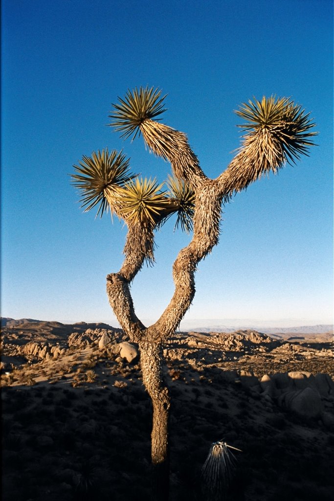
Joshua Tree National Park

Winter at Joshua Tree. Beautiful, stark, and cold (down to 20 F at night). For more images, click on the title.